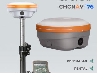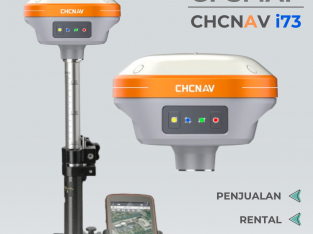
Keterangan
axis, barometrik altimeter, pemetaan dengan tampilan yang lebih tajam walaupun terkena sinar matahari, penerimaan sinyal GPS yang sangat sensitif, ditambah dengan slot memori untuk menambahkan peta, tahan air dan mengapung di air.
Physical & Performance:
Unit dimensions, WxHxD: 2.6 ” x 6.0 ” x 1.2 ” ( 6.6 x 15.2 x 3.0 cm)
Display size, WxH: 1.43 ” x 2.15 ” ( 3.6 x 5.5 cm) ; 2.6 ” diag ( 6.6 cm)
Display resolution, WxH: 160 x 240 pixels
Display type: transflective, 65-K color TFT
Weight: 7.7 oz ( 218.3 g) with batteries
Battery: 2 AA batteries ( not included) ; NiMH or Lithium recommended
Battery life: 20 hours
Waterproof: yes ( IPX7)
Floats: yes
High-sensitivity receiver: yes
Interface: high-speed USB and NMEA 0183 compatible
Maps & Memory:
Basemap: yes
Preloaded maps: no
Ability to add maps: yes
Built-in memory: 1.7 GB
Accepts data cards: microSD card ( FREE 2GB ! ! ! )
Waypoints/ favorites/ locations: 2000
Routes: 200
Track log: 10, 000 points, 200 saved tracks
Features & Benefits:
Automatic routing ( turn by turn routing on roads) : yes ( with optional mapping for detailed roads)
Electronic compass: yes ( tilt-compensated, 3-axis)
Touchscreen: no
Barometric altimeter: yes
Camera: no
Geocaching-friendly: yes ( paperless)
Custom maps compatible: yes
Photo navigation ( navigate to geotagged photos) : yes
Outdoor GPS games: no
Hunt/ fish calendar: yes
Sun and moon information: yes
Tide tables: yes
Area calculation: yes
Jangan lupa sebutkan PastiTerjual.com saat menelepon penjual untuk mendapatkan penawaran bagus


